
Maps and Meaning: How Borders Erased Our Story
Lines on Paper, Walls in the Mind
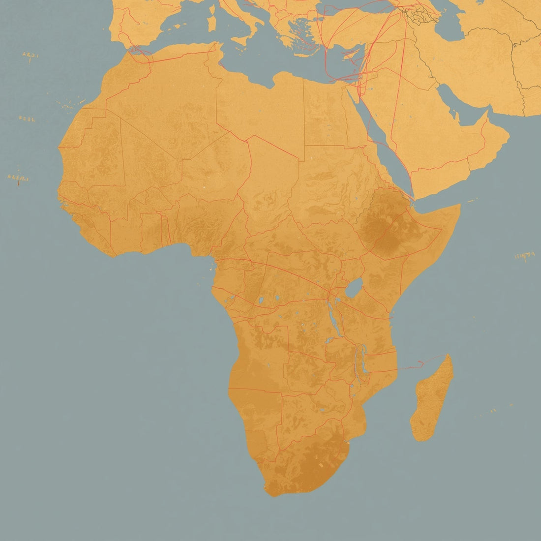
When you look at most modern maps, Africa is boxed in as though it were cut off from the rest of the world. The Horn of Africa is drawn as a sharp edge, while India is pulled far away across a blue sea. Europe and Russia are expanded, Asia stretched, and Africa is left diminished. But the truth is different: geography and history tell us Africa has never been separate.
Africa and Asia Were Always Connected
The Red Sea is no vast ocean — it is a narrow passage. The Horn of Africa and Arabia nearly touch, their cultures flowing across in boats, trade routes, and families. Ancient Ethiopia, Nubia, and Egypt were tied to Arabia and India through gold, incense, spices, and cloth. The Afro-Asiatic world was one of migration, shared language, and intertwined destinies.
Colonial Cartography
It was Europeans who redrew the maps to make Africa look isolated. They stretched Greenland and Europe larger than life. They made “Asia” so vast it could swallow India, China, and Siberia together, while severing Africa’s connection to Arabia and India. By splitting Africa away, they could say: Africa had no history, no civilization. The map became a weapon.
Why This Matters for Us
When borders are drawn wrong, stories get erased. Jesus, Miryam, and Yosef did not live in a world separated by sharp continental lines — they lived in an Afro-Asiatic world where Africa and Asia kissed at the water’s edge. Recognizing this truth restores us to a wider history: one where Africa was not cut off but at the center of trade, knowledge, and faith.
A Season of Reconnection
As we hang our ornaments and tell our stories this Christmas, let us also redraw the maps in our minds. The Holy Family’s names, their heritage, and their world all tell us the same thing: Africa has always been part of the center, not the margins. To reclaim the truth, we must also reclaim the map.